
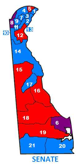
My biggest complaint about Delaware is the lack of online district maps. The General Assembly website tries but they post these almost unreadable PDF monstrosities that are all unconnected. Once and a great while the News Journal will do it, like when they had a district by district analysis of the Carney v. Markell primary. But throughout this whole redistricting process, I never saw a full state district map online or in the paper. Since pictures speak louder than words, especially in this day and age and in this visual society, you would have thought a picture of the originally proposed horrid V-shaped 12th Senate District that stretched from Newark down to below the canal over to Delaware City and then up to New Castle would have been useful to show how ridiculous that gerrymander was.
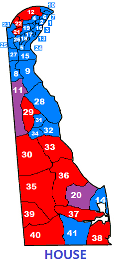
So I create my own maps, and since I am not a cartographer, these maps are not necessarily to scale, or even precisely accurate, but they get you close enough for you to place where the districts that we always talk here about are. In the maps below, I have colored in the respective district with the appropriate party color holding the seat now (of course blue for the Dems, blood red for the horrid teabaggers). The new districts (or the districts with a Republican and a Democrat currently representing it) are colored purple at this moment.
Amen
You did a nice job.